A powerful bomb cyclone linked to a significant atmospheric river is predicted to soak the West Coast, stretching from Washington to California, this week. It could bring potentially life-threatening flooding and blizzard conditions.
A powerful storm system will continue to bring heavy mountain snow, rain, and high winds to the Pacific Northwest and northern California through midweek.
Heavy rain and flash flooding potential exists across the central Gulf Coast over the next few days, including the Florida… pic.twitter.com/5ZbCE7zVTl
— National Weather Service (@NWS) November 19, 2024
The term “bomb cyclone” originates from the meteorological phrase “bombogenesis” or “explosive cyclogenesis.”
This phenomenon occurs when the central pressure of a storm system drops by at least 24 millibars within 24 hours.
This particular storm may reach historic levels of intensity. As noted by NWS Seattle, the lowest pressure ever recorded off Washington’s coast was 942 mb (27.81 inches) on Oct. 24, 2021.
Model predictions suggest that the storm’s pressure could approach this level by Tuesday evening, according to the FOX Weather Center.
‘High risk’ flood threat for Northern California
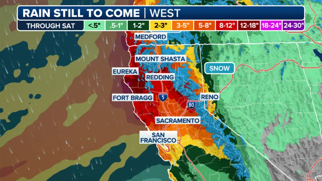
A significant surge of moisture is expected to arrive Tuesday night and remain in the area through late in the week, possibly extending into the weekend, according to the FOX Forecast Center.
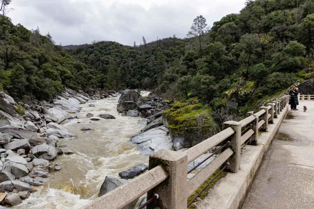
The system is anticipated to bring consistent, moderate rainfall over several days, which could result in flooded roads, streams, and even major rivers.
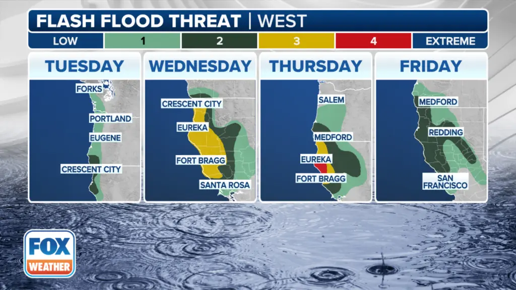
Northern California is expected to be the focal point of this atmospheric river.
Between Wednesday and Friday, some locations may experience 2-4 inches of rain per day, with even greater amounts likely in the mountainous regions.
In response, the Weather Prediction Center has issued a rare “high risk” flash flood warning for Northern California on Thursday.
80-mph winds possible
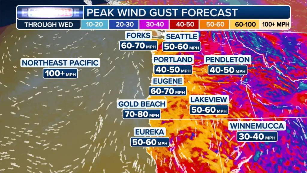
Strong winds are expected to pick up Tuesday evening as the storm approaches.
According to the FOX Forecast Center, gusts of 60-70 mph are anticipated in exposed locations such as ridges, headlands, and parts of the coastal plains. “The worst winds will occur Tuesday night and back off by Wednesday,” the center stated.
Blizzard in the mountains
In the Cascades, these strong winds will combine with heavy snowfall, creating hazardous blizzard conditions.
Travel conditions are predicted to become impossible from Tuesday evening through Wednesday morning.
As with most atmospheric rivers, this system is expected to bring significant snowfall to the Cascades and Sierra Nevada.
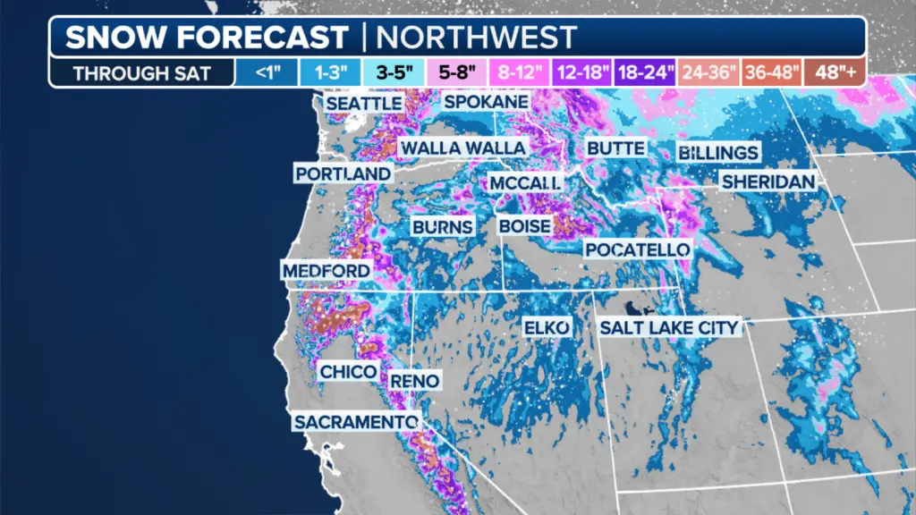
However, the influx of warmer Pacific air driven by strong winds will result in snow levels being higher than usual.
Blizzard Warnings have been issued for all of the Cascades from late Tuesday afternoon through Wednesday morning. This is where “high winds are most likely to overlap with snow and reduce visibility to a quarter-mile or less for at least three consecutive hours.”
Snowfall is expected to start at around 3,500 feet, with the heaviest accumulation occurring above 4,000 feet, leaving mountain ranges covered in several feet of snow.
Recreational boaters have also been warned to avoid venturing out to sea, while commercial vessels must prepare for extremely strong winds and hazardous seas. The best course of action is to remain in port until conditions improve.
A bomb cyclone, also known as explosive cyclogenesis, is a rapidly intensifying extratropical cyclone. It forms when the storm’s central pressure drops by at least 1 hPa per hour over 24 hours, creating a rapid and intense pressure drop.
This phenomenon is most common during the cold season, typically found about 750 km downstream from a mobile 500-hPa trough. It results in a powerful and dangerous system capable of bringing significant impacts to maritime regions.
With such severe warnings in place, mariners across the West Coast should take immediate action to protect life and property as this bomb cyclone intensifies.

